Understanding Climate Patterns: How El Niño Influences Global Tropical Cyclone Activity
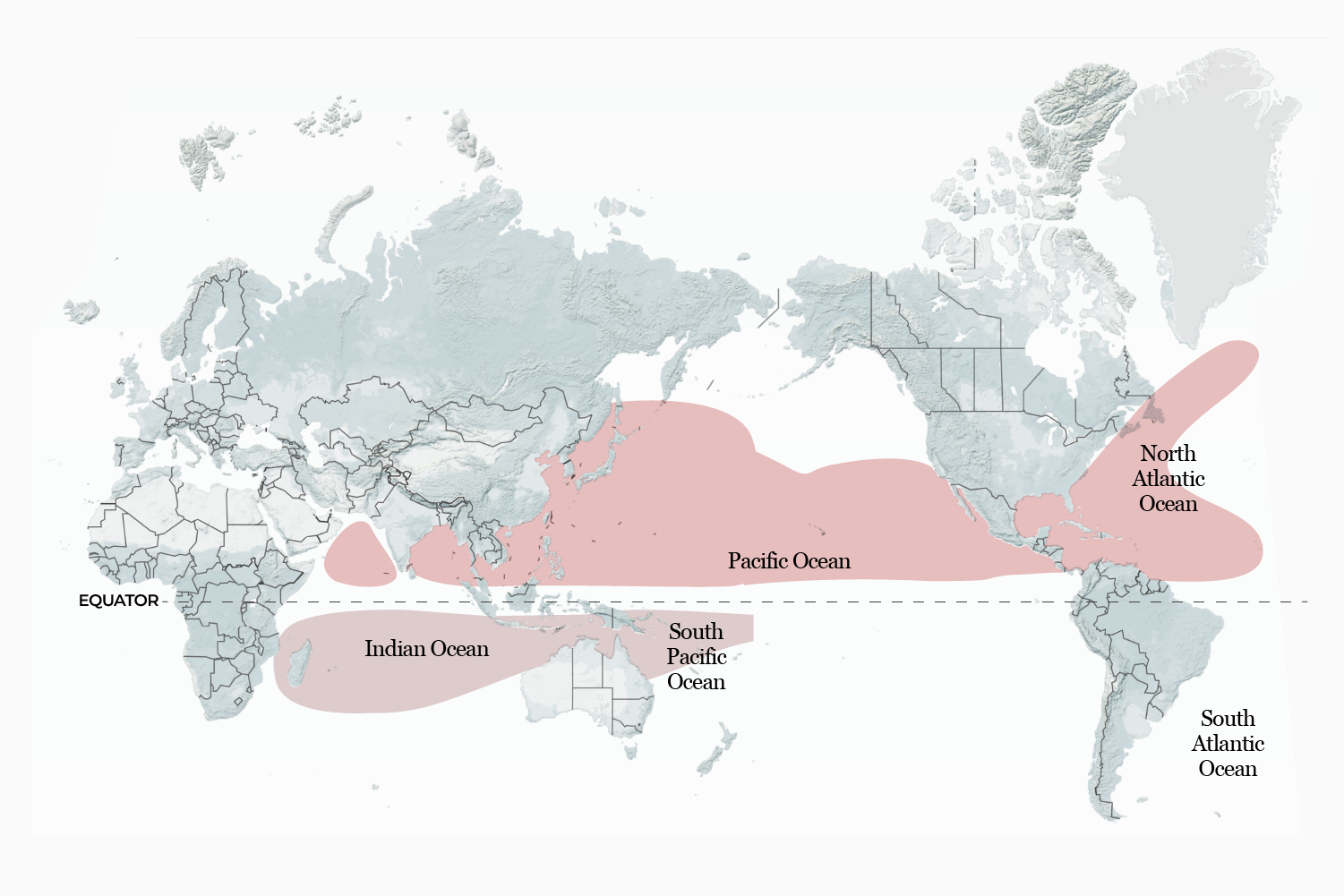
The state of global ocean temperatures plays a critical role in determining the intensity and geographic location of tropical storms across the world’s oceans. One of the most significant drivers of these variations is El Niño, a major climate pattern that causes measurable shifts in atmospheric conditions and sea surface heat. These natural cycles alter the energy available to developing weather systems, leading to divergent impacts in different regions.
Forecasters closely monitor these oceanic signals because they dictate the expected activity levels during peak storm seasons. For instance, one type of warming event, El Niño, is known to generally temper the threat of hurricanes in the Atlantic basin while simultaneously increasing the likelihood of severe storm development in the Pacific region. These shifts are not isolated incidents; they are manifestations of a complex, interconnected global circulation system.
What This Means for Storm Season Predictions
The anticipation surrounding tropical storm season is heavily influenced by these larger climate oscillations. When El Niño conditions are active, meteorologists adjust their forecasts to predict a distinct pattern: reduced storm energy in one major basin, coupled with heightened instability in another. This variance requires meteorologists to provide highly nuanced outlooks, moving beyond simple probability statements to explain the underlying physical reasons for the predicted changes.
The broader implications extend beyond just tropical cyclones. Because these massive climate patterns reorganize global wind and rainfall distributions, they can contribute to a wider array of extreme weather events worldwide. Depending on the phase of the cycle, the world can face increased risks of drought, intense flooding, or elevated average temperatures across vast stretches of land.
The Science Behind the Oscillation
These oceanic shifts are governed by a large-scale phenomenon known as the El Niño-Southern Oscillation (ENSO). This system describes the fluctuating temperature patterns in the central and eastern tropical Pacific. Under normal conditions, prevailing winds move warm surface waters away from the Americas toward Asia. This movement allows colder, nutrient-rich deep waters to gradually rise up along the American coast, maintaining a consistent thermal profile.
El Niño represents a disruption to this steady state. During this phase, the typical trade winds either weaken considerably or even reverse direction. This weakening allows the accumulated warm water pool in the western Pacific to surge eastward toward the Americas, significantly elevating sea surface temperatures in the equatorial regions. Conversely, its opposite, La Niña, occurs when the trade winds become exceptionally strong, pushing even more warm water west and causing the eastern Pacific to cool below its average baseline.
Understanding the mechanics of these cycles—the normal state, the warm surge of El Niño, and the cold push of La Niña—is fundamental to global weather forecasting. These periodic events, which can last for extended periods, force a measurable reorganization of the planet’s heat engines, thus shaping everything from rainfall patterns to the frequency of severe tropical weather systems across the globe.