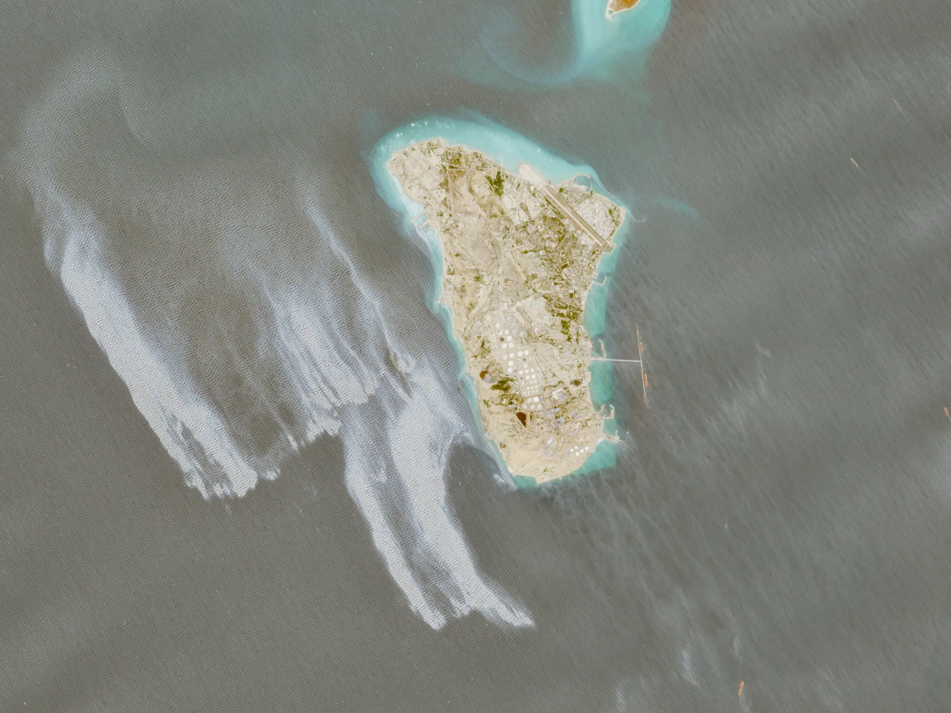
Satellite Imagery Captures Suspected Oil Slick Near Major Iranian Oil Export Point
Recent satellite surveillance has provided imagery suggesting the presence of a significant oil slick located off the coast near Kharg Island. This location is critically important to Iran’s energy infrastructure, functioning as a primary hub for the nation’s oil exports. The scope of the suspected spill, according to initial assessments from the aerial captures, covers a vast area, potentially spanning dozens of square kilometers.
While the mere sighting of such a spill naturally raises immediate alarm regarding environmental catastrophe, preliminary analysis from environmental monitoring groups suggests a potentially encouraging trend. These observers note that the affected slick does not appear to be static or expanding uncontrollably, indicating that the substance may already be undergoing natural dissipation or mitigation efforts are underway.
The focus of the monitoring effort is on assessing the full scale of the contamination risk. Given the geopolitical and ecological sensitivity of the Persian Gulf region, any spill of this magnitude warrants intense scrutiny from both environmental scientists and maritime authorities.
Significance and Implications for Maritime Operations
The potential contamination near Kharg Island carries substantial implications for regional maritime traffic and the immediate ecosystem. As a key export gateway, oil spillage not only poses a direct threat to marine biodiversity but also risks disrupting crucial logistical operations that depend on the stability of the adjacent waters. Furthermore, the concentration of oil near such a vital industrial zone necessitates rapid and specialized intervention to minimize environmental harm and maintain trade flow.
Understanding the Geographic and Industrial Context
Kharg Island’s significance cannot be overstated within the context of Iranian energy exports. Its role as a central export hub means that the integrity of the surrounding waters is paramount to the national economy. Historically, such areas have seen industrial activity, making them sensitive points for potential environmental incidents. The fact that environmental groups are already analyzing the images suggests an ongoing, vigilant watch is being kept on the situation, monitoring whether the slick remains contained or if deeper issues require specialized response protocols.
The convergence of significant industrial activity with fragile marine environments creates a perpetual point of risk. Therefore, the continuous monitoring provided by remote sensing technology, like satellite imaging, becomes an indispensable tool for authorities tasked with protecting both commercial interests and natural resources in the region.